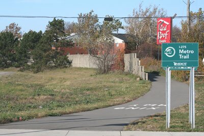
The I-275 Metro Trail stretches over 26 miles in Oakland County and Wayne County. The trail is primarily used for biking, but it can also be used for walking and jogging.
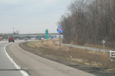
Much of the trail mimics the route of I-275. At the interstate's exits, the trail often angles away from the highway and parallels the off-ramps. To get around the I-96/I-275 interchange, the trail uses part of the Hines Park Trail to loop around, going along Hines Drive and part of M-14.
The trail underwent many improvements in 2010 and 2011, with new bridges and repaving of several parts of the trail. The trail segment north of I-94 has received most of the improvements. South of I-94, you'll find cracked or missing pavement along parts of the trail, which means you'll want to ride a mountain bike along this part of the trail.
The northern part of the trail starts near a guard rail on the east side of Meadowbrook Road in Novi. The southern starting point for the I-275 Metro Trail is at Will Carelton Road.
You will need to cross roads at various points to continue on the trail. Use caution and be alert when crossing the road, especially at the street crossings that are north of I-94.
The most convenient parking areas for the trail are located near Hines Drive in
Hines Park. Just south of the Northville Road/Hines Drive intersection, there is a parking area across from the trail. East of Haggerty Road, there is a parking area along Hines Drive that is not far from where the I-275 Metro Trail goes south towards Ann Arbor Road.