
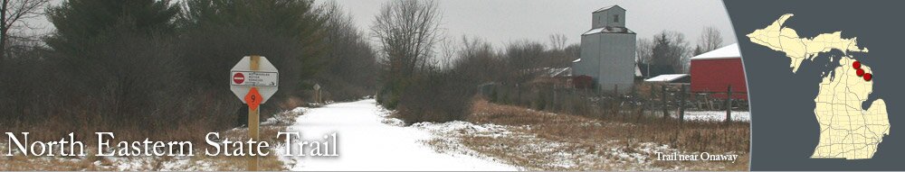
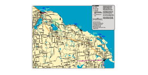
The North Eastern State Trail is used for snowmobiling, mountain biking, and hiking. The trail connects Alpena, Aloha, Cheboygan, Hawks, Millersburg, Onaway, and Posen. The route covers approximately 71 miles and has a crushed limestone surface. The trail between Cheboygan and Alpena passes through wooded areas, near farmland, and through a few small towns.
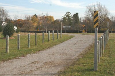
The trailhead in Cheboygan is located near the corner of Western and Lincoln Avenues. The trailhead has restrooms and a large parking area, which can accommodate snowmobile trailers. The trailhead also serves the North Central State Trail, which connects Cheboygan, Gaylord and Mackinaw City.
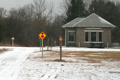
In Cheboygan, the North Eastern State Trail and North Central State Trail split south of Lincoln Avenue, with the North Eastern State Trail going south along Townline Road.
Alpena features miles of scenic waterfront and beaches on Thunder Bay. The area attracts scuba divers from all over, who explore the Thunder Bay National Marine Sanctuary, a protected area that features over 150 shipwrecks. The North Eastern State Trail ends north of Alpena Community College and not far from the Holiday Inn on US-23. There are many restaurants and shops along US-23 and M-32.
Onaway, Posen, and Millersburg are smaller communities that have family-owned restaurants and businesses. The trail passes just north of Onaway and goes through Millersburg and Posen. There are gas stations available at each of the communities, with the one in Millersburg being the closest to the trail.
The trailhead in Cheboygan is located near the corner of Western and Lincoln Avenues. The trailhead has restrooms and a large parking area, which can accommodate snowmobile trailers. The trailhead also serves the North Central State Trail, which connects Cheboygan, Gaylord and Mackinaw City.
In Cheboygan, the North Eastern State Trail and North Central State Trail split south of Lincoln Avenue, with the North Eastern State Trail going south along Townline Road.
Parking
- There is a large parking lot for the trail at the trailhead in Cheboygan, which is near the northeast corner of Western and Lincoln Avenues. Restrooms and a picnic shelter are available at the trailhead.
- In Aloha, you can park at Aloha State Park and access the trail.
- In Millersburg, there is a parking area near the trail at the end of Veterans Drive, near Maple Street.
- In Posen, the parking area is not near the trail; the parking area is off of First Street, not far from the back of the post office. A trail spur connects to the North Eastern State Trail.
Approximate Distances
- Cheboygan to Aloha State Park: 8 miles
- Aloha State Park to Onaway: 18 miles
- Onaway to Millersburg: 7 miles
- Millersburg to Posen: 19 miles
- Posen to Alpena (Woodward Avenue): 19 miles
- Total miles between Alpena and Cheboygan: 71 miles
About the Connected Communities
Cheboygan has nice sandy beaches at Gordon Turner Park and Cheboygan State Park. Cheboygan's lighthouse is located on the eastern edge of Gordon Turner Park. Most of the restaurants and lodging choices in Cheboygan are along M-27 or US-23.Alpena features miles of scenic waterfront and beaches on Thunder Bay. The area attracts scuba divers from all over, who explore the Thunder Bay National Marine Sanctuary, a protected area that features over 150 shipwrecks. The North Eastern State Trail ends north of Alpena Community College and not far from the Holiday Inn on US-23. There are many restaurants and shops along US-23 and M-32.
Onaway, Posen, and Millersburg are smaller communities that have family-owned restaurants and businesses. The trail passes just north of Onaway and goes through Millersburg and Posen. There are gas stations available at each of the communities, with the one in Millersburg being the closest to the trail.
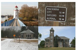
Photographs
Pictures of the trail, Alpena, Aloha, Cheboygan, Millersburg, Onaway, Posen, and more.
Before you go, get a map of the North Eastern State Trail.


|
|